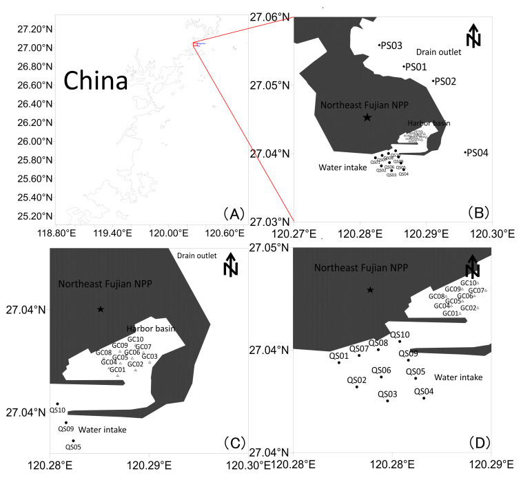
Figure 1. Map of sampling stations adjacent to the Northeast Fujian Nuclear Power Plant. (A) Geographic overview map. (B) Detailed map of the drain outlet zone (PS01–PS04). (C) Detailed map of the harbor basin zone (GC01–GC10). (D) Detailed map of the water intake zone (QS01–QS10). Star represents the location of Northeast Fujian Nuclear Power Plant.
Image published in: Huang W et al. (2026)
Image downloaded from an Open Access article in PubMed Central. © 2026 by the authors.
Permanent Image Page
Printer Friendly View
ECB-IMG-208584